By Avash Pandey/ICIMOD
 Dr Nupur Bose of AN College pointed out the gaps towards sectoral communication and co-ordination.
Bihar is regarded as the poorest state in India, and to make matters worse, it is also vulnerable to natural calamities such as floods and droughts. According to the Flood Management Information System (FMIS), Bihar is the most flood-prone state in India, with 76 percent of the population in North Bihar living under the threat of flood devastation. A staggering 73.06 percent of the total area of Bihar is routinely flood- affected. The main rivers descending from the Himalayan upstream sources include the Kosi, Gandak, Burhi Gandak, Bagmati, Kamla Balan, Mahananda and Adhwara, with only 35 percent of their total catchment area lying in Bihar.
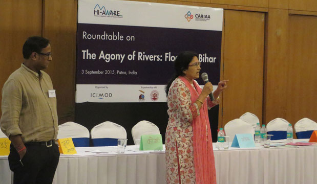
In the past, there have been numerous conferences and meetings among experts and policymakers from both Nepal and India to address the issues pertaining to the floods. In a similar vein, the Himalayan Adaptation, Water and Resilience (HI-AWARE) Research on Glacier and Snowpack Dependent River Basins for Improving Livelihoods programme, along with Megh Pyne Abhiyan (MPA) and the Central University of South Bihar (CUSB), organised a roundtable meeting on 3 September 2015 in Bihar, to discuss the floods that the floodplain population of the Ganges is currently facing.
According to Mr Mammen Matthew, senior editor of Hindustan Times, who has experienced the floods firsthand in Bihar on multiple occasions, the voice of the locals is not being heard and they are forced to come up with their own resilience strategies. Because the locals are always left out of these conferences and meetings, HI-AWARE designed this roundtable especially to hear the voice of the locals, and they were seated on the dais as chief guests. The locations of and the issues the people are facing are as follows:
- Supaoul (Kosi): waterlogged
- Saharsa (Kosi): inside the embankment
- Khagardia (Buddhi Gandak and Ganges): inside the embankment
- Madhubani (Bhutahi Balan): flash floods
- Pashchim Champaran (Pandai and Gandak): flash floods, regular floods
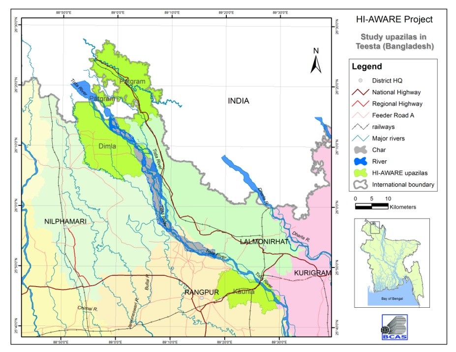 The flood-affected districts in Bihar.
Given the gender disparity in Bihar, HI-AWARE made sure that 50 percent of the participants from these communities were women. The meeting kicked off with a discussion of the perception of floods and the consequences faced by the affected communities. “We face drinking water issues and sanitation problems and we have no access to food during the floods,” complained a participant from Kothia village in Saharsa district, which is located inside the Kosi River embankment. The locals’ adaptation strategies to floods, such as machans (slightly elevated house structures), was proudly mentioned by one of the community members.
“We have floods because the upstream country, Nepal, opens the barrage gates for their population’s safety, risking the lives of ours here in Bihar,” said another participant, referring to the perceived cause of the floods . This misconception was immediately countered by an expert from ICIMOD, who clarified that it is the Government of India who is in charge of operating the barrage gates.
“Flash floods create havoc in our village and we are on a constant lookout for rain in the upstream hilly regions of Nepal,” said a participant from Pashchim Champaran district. Keeping a lookout thus was the villagers’ own method of Early Warning System (EWS).
“EWS create confusion and panic amongst people,” said a participant from the audience, questioning the reliability and effectiveness of EWS. An expert on EWS from Practical Action-Nepal clarified that EWS’ accuracy range from 80-90 percent and that the effectiveness is case based.
The post-lunch session of the meeting was designed to focus the discussion by experts along the three areas of research, policy and practice. Various research agenda such as: “focusing not only on large rivers but also on smaller rivers; the unpredictability of rainfall events leading to flash floods; knowledge-based farming to improve livelihood, etc.” were proposed by the experts.
“Why not focus on the ‘Joy of the River’ than on the ‘Agony of
River’?” said Dr Philippus Wester, Chief Scientist, Water Resources Management, of ICIMOD. He gave examples of measures that have been adopted in The Netherlands, where he comes from, on managing the river basins, and he also talked about issues related to floods and how knowledge can be transferred globally.
The experts then summarised the dialogues on the review of the central disaster management policies and the lack of water policy (quality, quantity) in Bihar. The experts said that the traditional knowledge of water resources and irrigation and adaptation strategies could be used to further increase resilience in the communities.
“It was interesting to witness contrasting views presented under the same roof,” said Dr Arun Bhakta Shrestha from ICIMOD. He outlined the success of the meeting and talked about how traditional and modern knowledge should be merged to create an integrated approach. He also stressed that because HI-AWARE was a part of ICIMOD, the latter’s being a regional organisation meant that it had the ability and expertise to address such trans-boundary issues.
[Note: You can download the full roundtable report HERE. ]