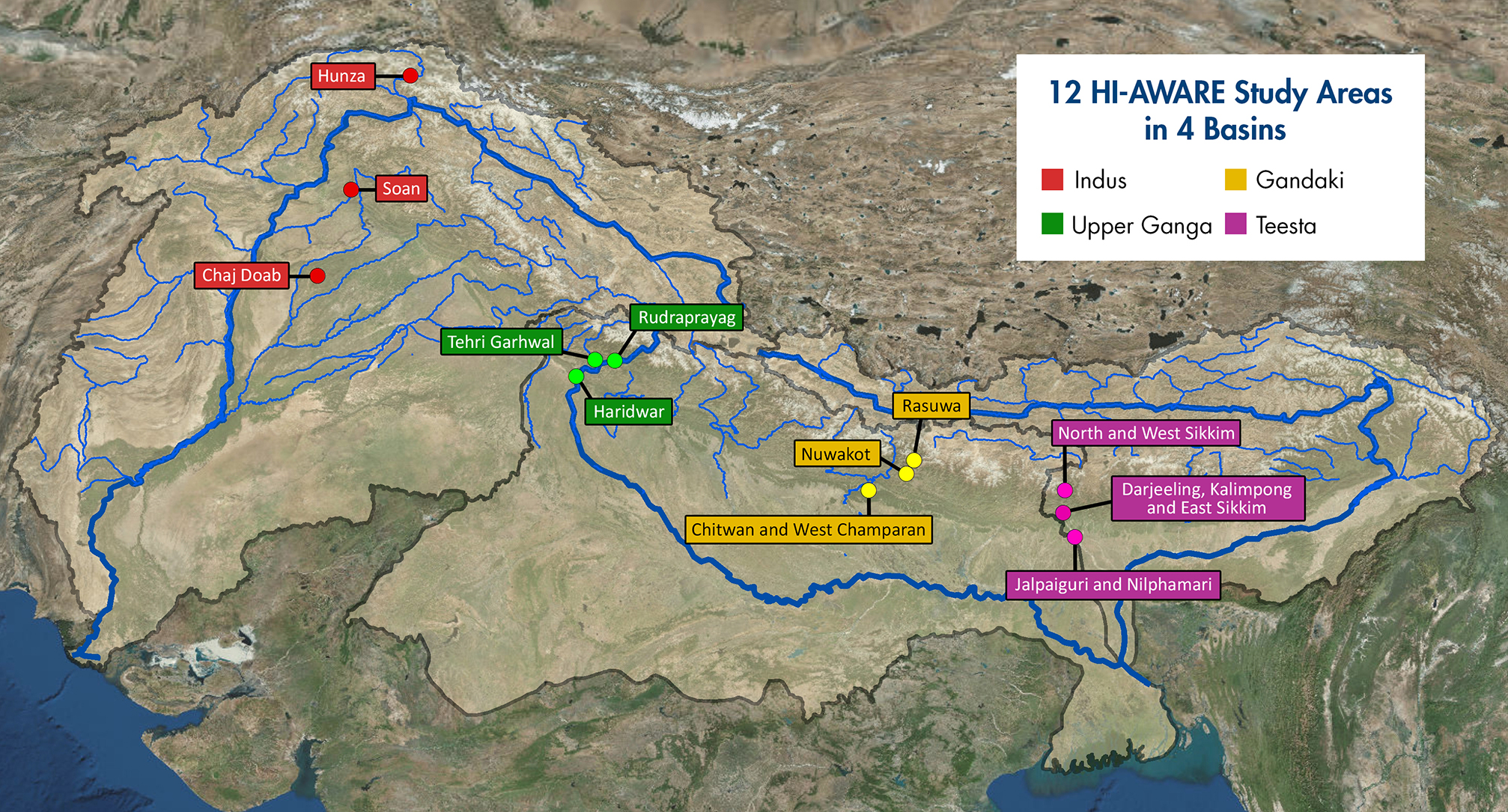
The HKH region comprises regions with varying topographies and climatic conditions. There is acute need to conduct studies on the ground, collate the findings generated and use them to inform adaptation measures. HI-AWARE will focus its activities in 12 sites that represent a range of climates, altitudes, hydro-meteorological conditions, rural-urban continuums, and socio-economic contexts in four study basins: the Indus, Upper Ganga, Gandaki and Teesta.
It will conduct research in these sites, including modeling, scoping studies, action research, and randomised control trials. It will test promising adaptation measures in observatory labs at the sites for out-scaling and up-scaling. It will also conduct participatory monitoring and assessments of climate change impacts and adaptation practices. These activities will seek to identify:
- Critical Moments– times of the year when specific climate risks are highest and when specific adaptation interventions are most effective;
- Adaptation Turning Points – those points in time when current policies and management practices are no longer effective and alternative strategies have to be considered; and
- Adaptation Pathways– sequences of policy actions that respond to adaptation turning points, by addressing both short-term responses to climate change and longer-term planning.